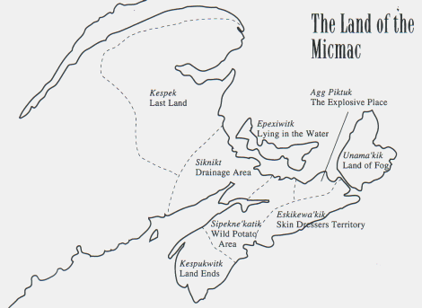
MAP: Land of the Mi'Kmaq - Mi'kma'ki Mi'kmaq Territory consists of all of Nova Scotia and Prince Edward Edward Island, New Brunswick (North of the Saint John River), the Gaspe of Quebec, and it is surmised by many that it included part of the State of Maine and part of Newfoundland In case you have a hard time reading the names of the Districts on the Map the following are their names: Kespukwitk, Sipekne'katik, Eskikewa'kik, Unama'kik, Epekwitk Aqq Piktuk, Siknikt, and Kespek. The English translations are shown on the map. Because of the different perceptions of things by the two peoples, they are as close as one can come to conveying their true meaning in that language.

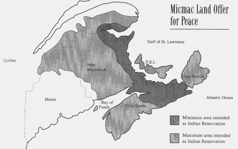
MAP: Land Mi'Kmaq offered British for peace The offer was rejected out of hand by the British because they thought it too extravagant, they wanted it all! To read more click:http://www.danielnpaul.com/Mi'kmaqPeaceOfferToBritish-1754.html
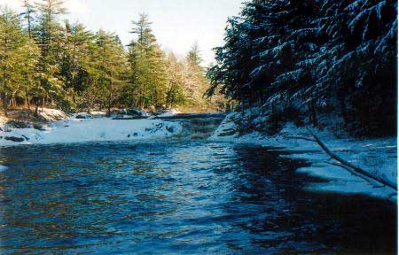
 Mills Falls: Kejimkujik
Photo by Daniel Paul
Click the following to find Websites for Mi'kmaq First Nation Communities, and short history of how they were organized under the Indian Act Mi'kmaq First Nation Communities
Please visit the following URL to get a wider perspective on how Indian Affairs mismanaged the Indian Trust Funds belonging to the Mi'kmaq First Nation Communites in Nova Scotia:
http://www.danielnpaul.com/NovaScotiaMi'kmaqBands.html
|


